Main menu: Home Features 3D Maps User Guide Support Buy Now Disused Tube Blog

Roundel me this, Google

Oh Google Maps, what have you done?

They're not roundels!

They’re not roundels!

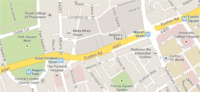
We first spotted it on Monday morning – when skimming through Google Maps, and we noticed that the blue & red ’roundel’ symbol used to represent tube stations on Google Maps had been replaced… by a white ‘M’ on blue – the same symbol as used on the New York Subway – ‘M’ for Metro, presumably? (The same symbol which is incidentally used in the UK, up in Newcastle on the Tyne & Wear Metro system)

Some people speculated that it might not be a Google error, but TfL clamping down on the use of the roundel symbol.

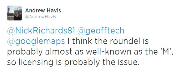
Licensing issue?

Licensing issue?

But hang on – if that’s the case, then why was the roundel still in place on Google Maps for the London Overground – where the colours are slightly different! That doesn’t make sense.

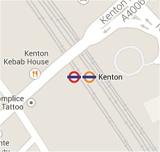
Kenton has both

Kenton has both

We then noticed that in some places where tube stations AND Overground stations are the same station, then the tube roundel still existed alongside the Overground roundel.

But this didn’t apply to all places – at Harrow & Wealdstone, the ‘M’ symbol was in place instead of the tube roundel (alongside the Overground roundel and the NR symbol which is correct)

Then, a news story popped up from ITV London news on Wednesday, reporting that Google knew about it, “There are currently engineering works on the Google Line. Normal services will be resumed shortly.”

Londonist ran an article on it too, reporting the same thing.

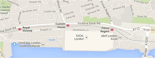
Then – to compound the issue – this morning we now note that DLR stations in London have had their symbol replaced by the National Rail ‘BR’ type symbol too! Which is also completely wrong …

DLR now National Rail!

DLR now National Rail!

So with it looking like it’s getting worse, rather than getting better – maybe it’s time to resort to a Twitter trend to get this fixed! #GiveUsBackOurRoundel – anyone?
Let's get it trending!

Let’s get it trending!

03 Jul 14

New lifts at Hampstead Heath

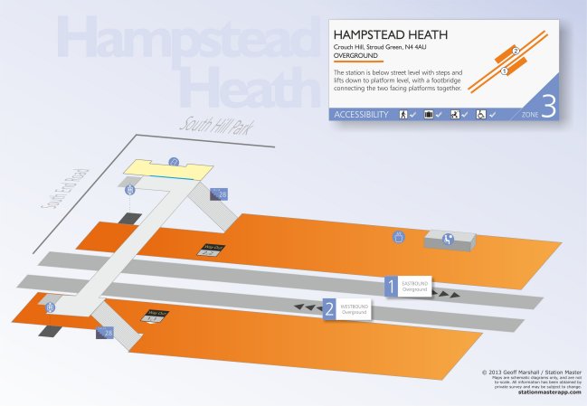
Hampstead Heath became a fully accessible station the other week, with the introduction of two new lifts to both platforms bringing step-free access to this Overground station.

The ticket hall area has been redesigned as well with a wide gate, newer regular ticket gates and a step free entrance.

We of course went down there to have a look (photos tomorrow) but immediately you can have a sneak preview of the 3D map of what it looks like which will be in the next update of the App.

3D map of Hampstead Heath

3D map of Hampstead Heath

08 May 14

Walthamstow’s Second Entrance

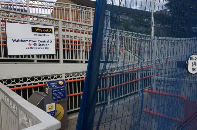
Here’s the rather disappointing view that greeted us when we swung by Walthamstow Queen Street the other day when we were in the area.

Thou shall not pass

Thou shall not pass

About a year ago, they built steps and ramps on the north side of the station to allow another way in and out of the station, but although the access infrastructure was put in place, it was blocked by a temporary gate because the Oyster card readers were not in place.

Well, it’s been over a year now, and yet although the Oyster card readers are now clearly visible in the picture and installed, it seems that officialdom and red-tape is still holding things up, and the entrance is STILL not open … for reasons which we cannot fathom at all.

03 May 14

New barrier gates

We used the Gospel Oak to Barking (GOBLIN) branch of the Overground on Friday’s charity tube challenge, and noticed two things of interest.

After a year of the new ramp being put in place, the temporary barriers are still across at the the top of the northern entrance/exit at Walthamstow Queen St. station – no one seems to quite know why they haven’t got on with opening it up, and it’s been like that for a year now.

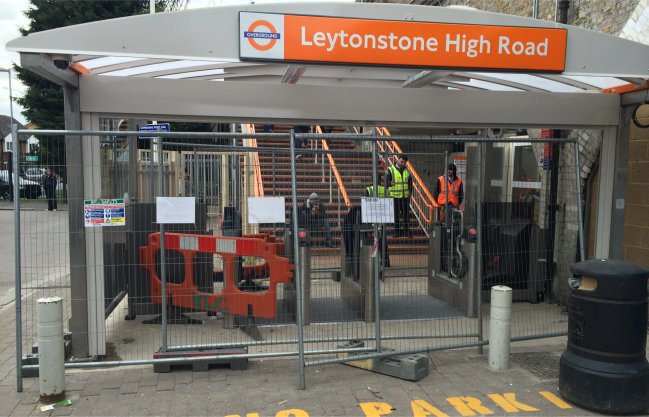
Especially when ticketing work is well underway and in progress as we witnessed here at Leytonstone High Road where a new gateline is being installed, and might already be functional by the time that you read this.

New Ticket Barriers

New Ticket Barriers

07 Apr 14

Over Rated

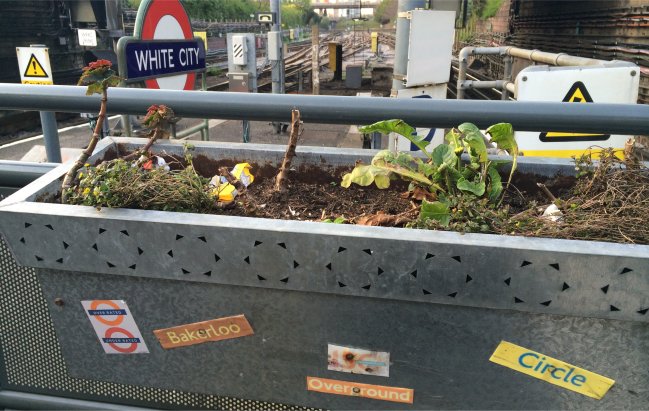
We spotted this on the Central Line at White City recently – at the western end (front of the train) of the westbound platform.

It’s a flower box, with stickers celebrating 150 years of the Underground, and for reasons that we can’t fathom – the Bakerloo and Circle Lines, and one for the Overground too.

But we like the two roundels in the bottom left of the photo best, where the Overground is called ‘Over Rated‘ and the tube coloured one ‘Under Rated‘.  Someone at White City doesn’t think the Overground is that great, huh?

Not a fan of the Overground

Not a fan of the Overground

01 Apr 14

Overground to Chingford, Cheshunt and Enfield

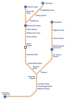
Overground ExtensionWe’re a little puzzled here as to why this became a ‘news’ story again this week, when the Evening Standard ran a story that had already been confirmed back in July 2013 – that TfL were taking control of the West Anglia services out of Liverpool Street to Chingford, Cheshunt and Enfield.

In fact the only ‘new’ thing that we could find (but we’d assumed anyway) is that the new Overground service will indeed appear on the tube map.

The ES and Time Out Blog (who got excited about it too) ran a clean map showing what the services would look like out of Liverpool Street, but what’s actually worth considering is how messy this is going to look when you throw in all the other tube lines – and Crossrail as well.
Knowing that TfL have publicly stated their desire to take over more inner suburban London rail services, to become ‘Overground’ too – at what point is the tube map going to look just too cluttered and TfL will have to bow to the pressure of a redesign?

Overground Extension Map Congestion

Of course, a map for all railway services already exists, but you don’t see this in printed pocket form at tube stations – and that’s where we suspect something new is going to have to be created. If they keep adding in new Overground lines, the map is going to look horribly cluttered and not that usable or readable at that size – look for example how squashed London Fields, Cambridge Heath and Bethnal Green already are – so surely something, somewhere, is going to have to change…

09 Jan 14

Olympia Map

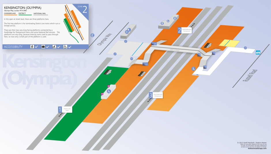
As Olympia has had quite a re-vamp with the gateline and the new segregated footbridge, we’ve updated the 3D Station Map for the station which now reflects all of this.  It will be included in the next version (1.7.1) of Station Master which we submitted to Apple today.

Here’s a sneak preview of what the new Olympia map looks like – Click on the image below for a larger/full size version.

3D Kensington (Olympia) Map

3D Kensington (Olympia) Map

Whilst we were there, we spotted some irregular train service patterns too, but more on that in tomorrow’s post…

30 Dec 13

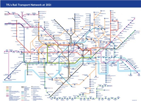
Future Transport Tube Map, 2021

TfL produced a draft copy this week of what they think the tube map will look like in 2021.

2021map_650

Obvious things to spot on there is Crossrail now spanning west to east across the map, the new Watford extension (with Cassiobridge and Watford Vicarage Road stations on the Metropolitan Line), the possible Northern Line extension (with Nine Elms and Battersea stations), but what’s new to appear on a proposed TfL map for the first time are the services out of Liverpool Street to Enfield Town, Cheshunt and Chingford.

It adds more spaghetti to the orange mess that is the Overground already the top right of the corner of the map is now looking most cluttered.

King-of-the-clutter though is still (of course) the patronising ‘blue blob’ of accessibility, and with the new Overground and Tramlink on the map (although, Tramlink always appears on proposed tube maps, but never makes the final editions) there are more blue blobs than ever – so much so we counted them up.

There are 222 stations that are ‘blue blobbed’ on this version of the map now, and just one more – 223 that do not!  So it’s almost at a 50:50 split.

So let’s apply some logic to this.  If 99% of stations on the map were step-free accessible you would obviously just mark (with a new symbol of some sorts?) the minority of stations which were NOT step free.   So – given that over time, more stations are going to become step free, at what point will TfL sensibly drop the blue-blob, and just highlight non-step free stations instead?

07 Dec 13