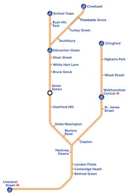
 We’re a little puzzled here as to why this became a ‘news’ story again this week, when the Evening Standard ran a story that had already been confirmed back in July 2013 – that TfL were taking control of the West Anglia services out of Liverpool Street to Chingford, Cheshunt and Enfield.
In fact the only ‘new’ thing that we could find (but we’d assumed anyway) is that the new Overground service will indeed appear on the tube map.
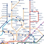
The ES and Time Out Blog (who got excited about it too) ran a clean map showing what the services would look like out of Liverpool Street, but what’s actually worth considering is how messy this is going to look when you throw in all the other tube lines – and Crossrail as well.
Knowing that TfL have publicly stated their desire to take over more inner suburban London rail services, to become ‘Overground’ too – at what point is the tube map going to look just too cluttered and TfL will have to bow to the pressure of a redesign?
Of course, a map for all railway services already exists, but you don’t see this in printed pocket form at tube stations – and that’s where we suspect something new is going to have to be created. If they keep adding in new Overground lines, the map is going to look horribly cluttered and not that usable or readable at that size – look for example how squashed London Fields, Cambridge Heath and Bethnal Green already are – so surely something, somewhere, is going to have to change…
