With the announcement of the new fares for 2016 by TfL, they also confirmed something that has been planned for while – Stratford station is being changed from being Zone 3 only, to be a boundary Zone 2 & 3 station.
But here’s the bit that we didn’t know about – several other stations in the area are also becoming boundary 2 & 3, that were previously just zone 3 – basically following the DLR line south, those being – Stratford International, Stratford High Street, Abbey Road, West Ham, Star Lane and Canning Town and all changing too.
But the really interesting thing, is that the stations that are currently boundary Zone2/3 in the area don’t appear to be changing. Hang on, what! Yes – they will ALSO be boundary Zone 2 and 3.
And that got us thinking. If you look at the boundary zone between 2 and 3 in a geographical way it’s currently a nice smooth curve, but when the changes happen, it will change to look like, well … this!
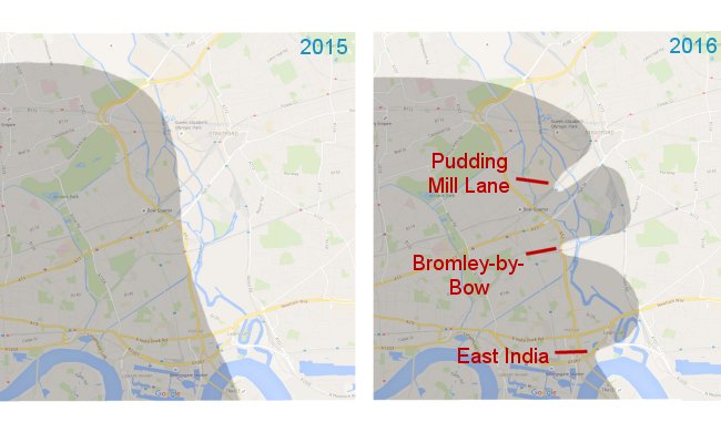
The Boundary of Zones 2 and 3 in the east