A visit to the LT Museum Acton Depot last weekend is always an enjoyable thing and never a waste of time. We always make sure we head for the mezzanine at somepoint which has all the tube maps and signs, and gawp as we go back in time to how the transport network used to be. In particular this time, a pre-Beck map for 1926 had us comparing differences between what used to be, and how it is now…
1926 Map
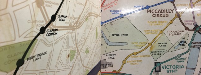
Here’s where Clapham North was called “Clapham Road”, and what we know as Clapham South was almost called Nightingale Lane – but this never appeared in a printed tube map, just this poster. Green Park was of course Dover Street, but on this map labelled as “Dover Street (St. James)” which we had never seen before.
Another bit of 1926
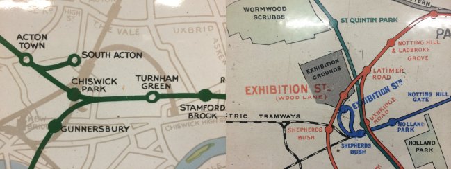
in 1926 the Hounslow Barrack to South Acton service (and Acton Town to South Acton one-carriage shuttle) was in operation – look though also at the curve of track that goes just to the right of Turnham Green – an old non-tube railway that used to run. And the lovely curve of track (when the Central Line was blue) and Wood Lane was referred to as ‘Exhibition Station’ instead.
Last bit of 1926
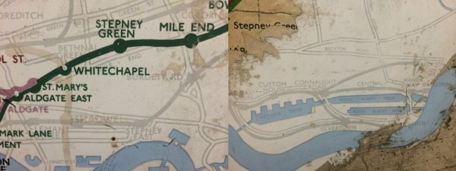
And out east .. when Limehouse was called Stepney East, and you can also see plenty of remnants of the railway that existed in the Docklands area before the DLR came to be, including a station at Connaught Road – now the site for a major tunnel for Crossrail.