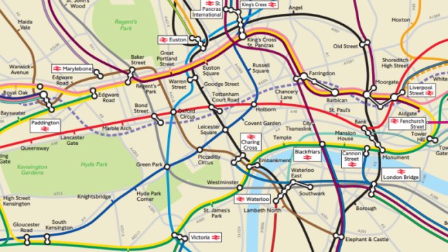
As far as we can tell – this article from City Metric – has stumbled upon what may be TfL’s own internal geographically accurate London Rail map.
It contains physical features too such as London’s parks and the M25, as well as the Thames, and it does, as you would expect, let you get a real feel for how densely packed the stations are in the inner area of London as opposed to out in the suburbs.
Update:
TfL have now put this map on their own website on this page here.