Ah, you have to love the Freedom of Information Act, under which large companies and corporations are obliged to release certain information to the public upon request.
The latest gem to emerge is from a request to LU/TfL here, where someone had requested a detailed signalling and track plan map.
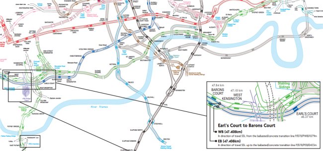
They don’t quite meet the requirements with their response (if you read it carefully you can see why they don’t have to), but they do link to a rather fabulous – and previously unseen by this Station Master – map of the Underground, a small section of which we’ve got for you here.
Follow this link for the full map, but be aware it’s 17MB in size, so will take a longer time to download on slow connections.
Pedants will note that it’s a little out of date where in concerns non-Tube lines, if you look closely at Stratford it still shows the old ‘Silverlink’ North London Line track which has now been replaced by the DLR. You might argue too, that the Thameslink track to Barbican shouldn’t be shown, as this service no longer runs and is being turned into Crossrail, but it’s still a beautifully detailed map that even shows disused stations and unfinished ones (such as Bull & Bush on the Northern Line).
LU Track Plan Map